戰
地
轉
身
・
轉
譯
再
生
馬
祖
MATSU


GAZING
FORTRESS
MATSU
據點深呼吸 帶著歷史往前進
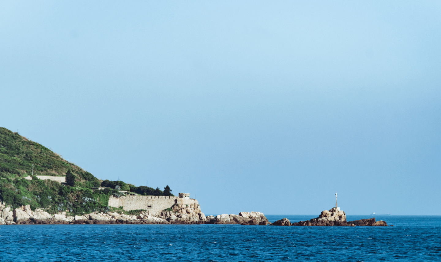
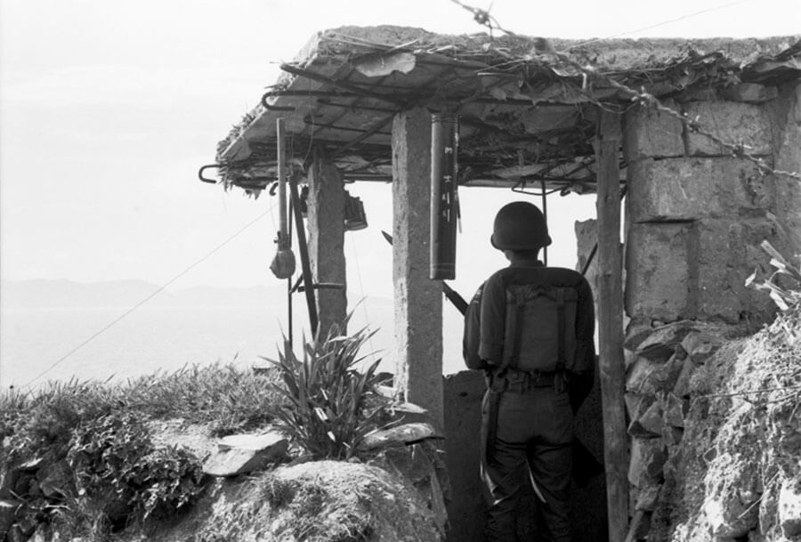
馬祖列島位於台灣海峽西北方,主要由南竿島、北竿島、東莒島、西莒島、東引島及其附屬礁嶼等36個島礁組成,與中國大陸僅一水之隔,最近距離為9.25公里。馬祖在國共對峙與美蘇冷戰中為反共的防禦最前線,也是東亞島鏈的其一環。各島海岸邊緣遍佈軍事據點構成防禦網,形成獨特的戰地景觀。馬祖列島從前戰地時期中國大陸沿海邊陲的漁村小島到在世界史上佔有一席之地的冷戰熱點,而在後戰地時期轉向以觀光為目標的發展方向。站在海防據點面向寬闊海洋的同時,也從軍事遺跡中感受到戰爭的嚴峻和殘酷,如此矛盾的存在正是馬祖歷史的寫照。
The Matsu Islands are located in the north-west of the Taiwan Strait, facing the mouth of the Minjiang River, separated from mainland China by the water. Matsu Islands consist of 36 islands and reef including Nangan Island, Beigan Island, Juguang Island (East Juguang and West Juguang), Dongyin Island and their affiliated islands. The nearest spot is only 9.25 kilometers away from China. In the Cold War, Matsu was standing as frontier to against the Communist China and conflict center between the America and Soviet Union. It is also a part of First Island Chain. In order to complete the defensive deployment, Matsu islands’ coastline are dotted with strongholds and resulted in the unique cultural landscape of military heritage in Matsu. From a remote fishery island along the coast line to one of important hotspot in Cold War period, Matsu has experience different stages of change, from intensive military controlled to popular tourist destination. Standing on the fortress, we face expansive ocean and sense the peace from scenery, however, we also learned the severity and cruelty of the war from military remains. The existence of such contradictions is a portrayal of Matsu history.
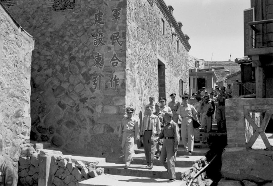
南竿是馬祖列島中所屬面積最大、人口最多的行政區,是連江縣政府所在地,以及交通、經濟、教育及文化中心。
Nangang Island is the biggest island and has most residents among Matsu islands. It is where Lien Chiang Government located and the center of transportation, economic, education and culture.
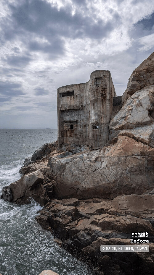
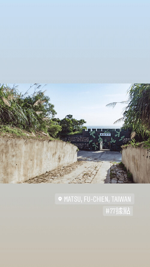
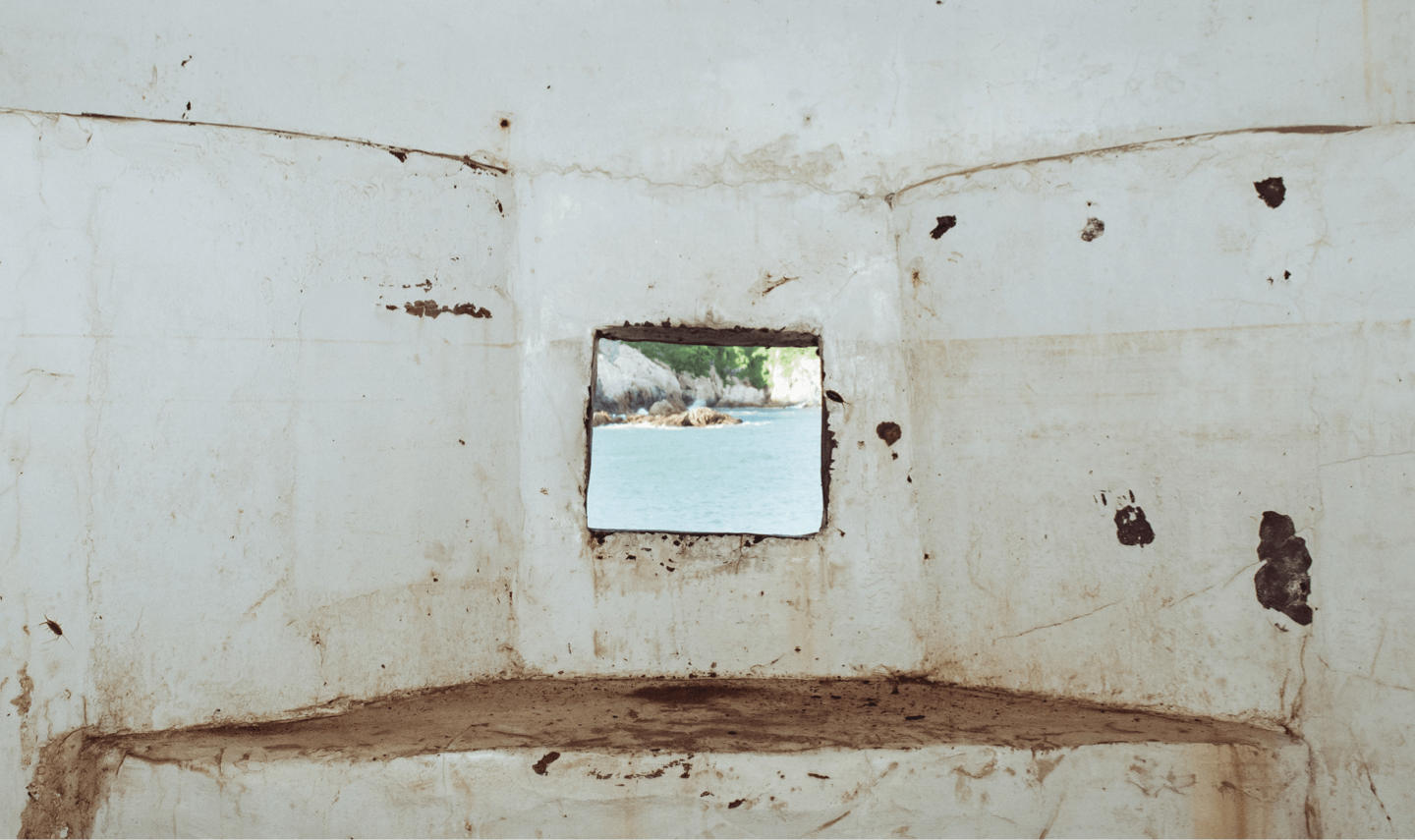
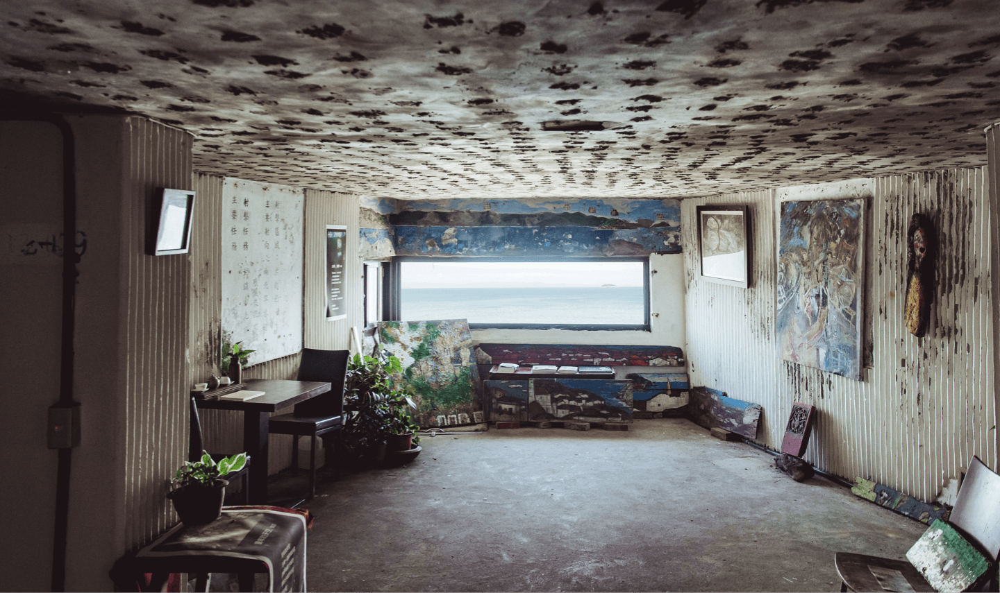
Decades after the ending of military controlled epoch on Matsu Islands, the remains and landscape from battlefield have been preserved and left behind to this day. While some of the fortresses still work as military base, some have been transferred into a sight-seeing venue for tourism. They represent the most iconic military heritage of Matsu. In the same time, there are some fortresses transformed into alternative spaces with new function and context by public and private sectors. Today, all the fortresses evolve through times but present different stages of change, and compose a very unique landscape of Matsu. The co-existence of varied condition of fortress not only present the change of history, but we can see the diverse narratives from every individual of them. “Gazing Fortress Matsu” is initialed in this period of time, it is advanced stage of “from battlefield to tourism”. The methodology of reinterpretation was implemented to reconstruct the diversity of Matsu and present its historical value and spatial characteristic. The project focuses on those military remains which embedded at the edge of island, the most iconic and representative venue – fortress. Through dialogue, in-depth interview and cross discipline coordination of Matsu communities’ living condition and economic potential, we connect the islands’ past, present and future. By means of design power and cultural competence, we raise discussion and give the military heritage a new life and contemporary meaning.


Matsu official ended the period of Martial Law and opened its door and started autonomy in 1992. Then in 1999, Matsu was planned and executed as Matsu National Scenic Area. The next year, the Mini Three Links were executed between the People's Republic of China's Fujian province cities of Xiamen, Mawei and Quanzhou, and the islands of Kinmen and Matsu. Matsu has turned from the frontier of conflict among two governments to the hotspot of communication. Since 2000, Matsu also has changed from an intensive military controlled and potential battlefield into a tourism island, and gradually become a platform open for discussion and dialogue.

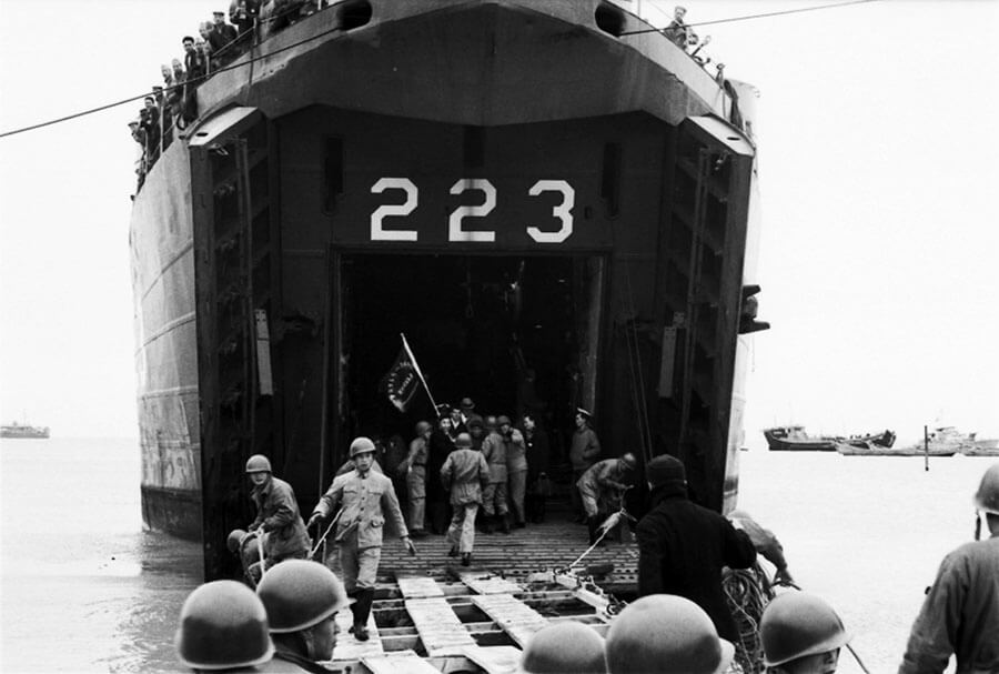
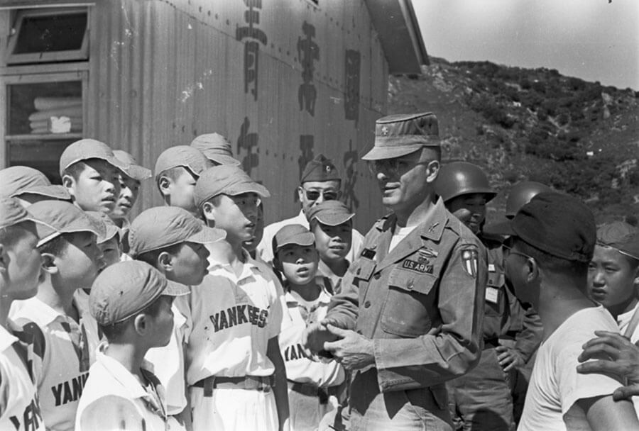
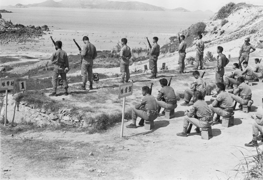
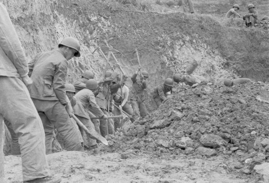
In 1949, the Nationalist was defeated by Communist China in the Civil War and retreated to Taiwan. Since then, the actual governance of Republic of China was limited in Taiwan, Penghu, Kinmen, Matsu and islands on partial Southern Sea. Therefore, Kinmen and Matsu were two iron fists extending from Taiwan due to their location nearby China’s boarder. Unlike Kinmen, there wasn’t any actual battle happened on Matsu. The Matsu has experienced a long preparation for battle and waiting for battle to happened until 1992.

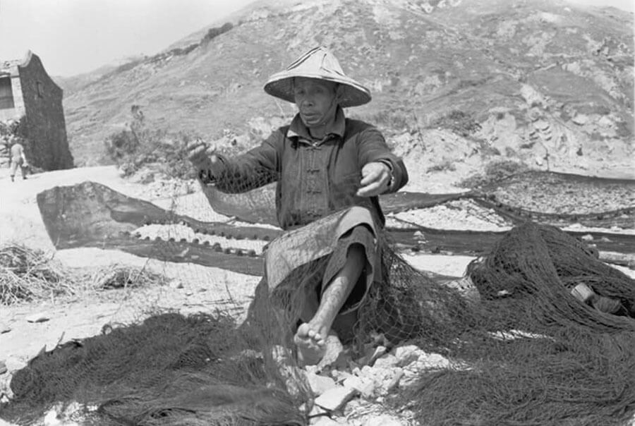
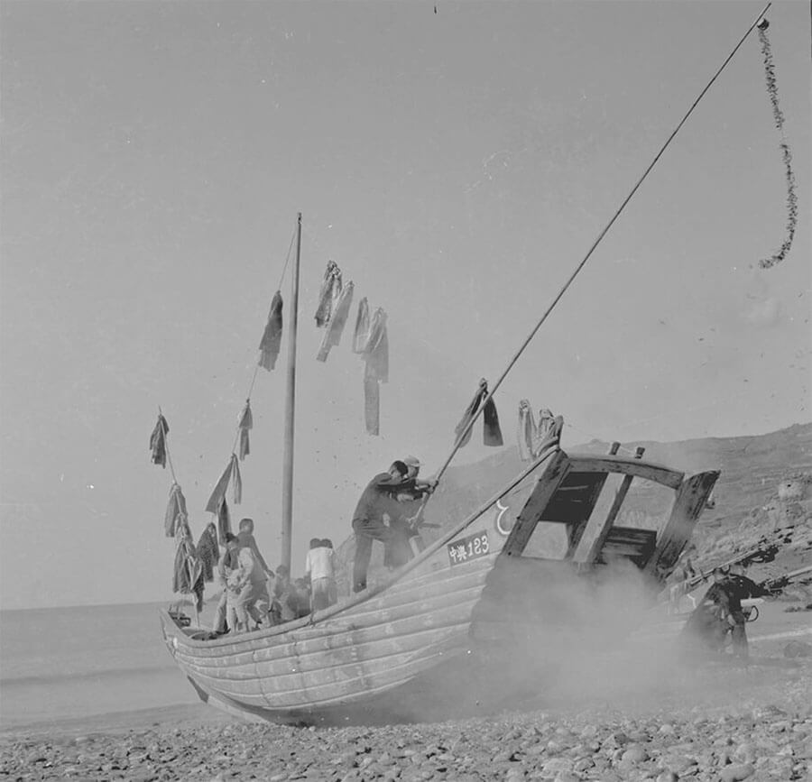
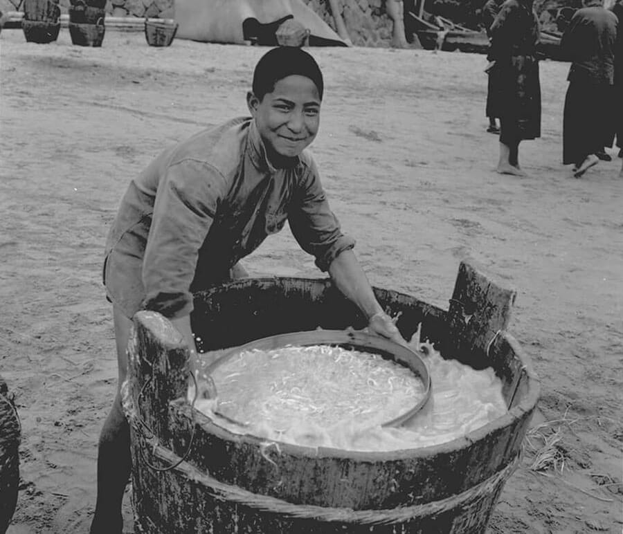
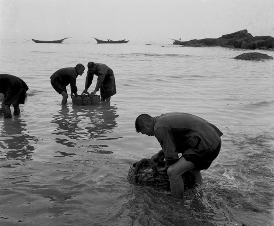
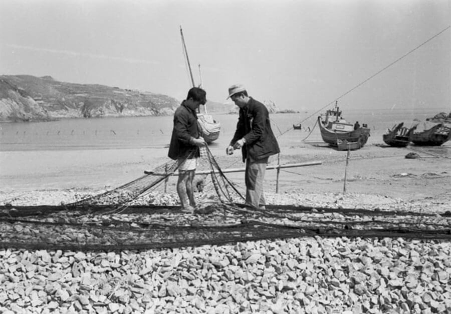
According to the archeological evidence, the debut of Matsu history can be dated back to the Neolithic period from 8300 B.C. However, Matsu was lack of military importance in Chinese history due to its distant position to the central power location. Matsu was regarded as one of thousand islands along the China’s coast line. Therefore, it was also a shelter for exiles when the political situation is chaotic. In the recent eras, most of the residents on Matsu earned their living from the ocean, fishery was the main industry and it resulted in that most settlements were gathered around the bays throughout the islands.
莒光位於列島最南端,包含東、西兩島。東莒島上有國定古蹟東莒燈塔與縣定古蹟大埔石刻,以及福正、大浦兩座傳統閩東聚落。
Juguang includes East Juguang Island and West Juguang Island and locates at the southernmost point of Matsu Islands. There are several historical sites on the islands, including national heritage Dongquan Lighthouse and Lien Chiang County historical reserve Dapu Inscription of East Juguang Island, and plus two traditional East Fujian Villages – Dapu and Fucheng.
莒光位於列島最南端,包含東、西兩島。西莒雖是莒光鄉行政中心所在,但觀光化程度較低,保有戰地神秘氣息。
Juguang includes East Juguang Island and West Juguang Island and locates at the southernmost point of Matsu Islands. Although Juguang Township’s administration center is on West Juguang Island, it has less development for tourism and still persevered the mysterious atmosphere which left from military controlled era.
「傾聽島嶼的聲音」是一個重新思考馬祖這塊土地的藝術採集計畫。整體計畫以場域系譜的研究與調查為基礎,以地景作為檔案(Landscape as archive)的觀點,從地景資源的再發現,從我們所見、所聞、所觸的環境感知參照馬祖獨特的歷史脈絡與社會組成,以理解與再現地景的動態過程,重而開啟新的島嶼認識論。
“Listening the Voices of Island” is the art project which providing multiple methods of re-thinking Matsu. This project based on field research and analysis of site genealogy. Through the perspective of “landscape as archive”, the project aims to re-explore island’s natural and cultural resources, and to see, to hear and to sense the environment which reflecting the unique history and social background of Matsu. The project is a dynamic process to realize and represent the landscape, in order to open a new island epistemology.
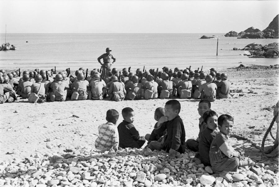
馬祖可見與不可見的戰地風景,無論是對於當地居民或是曾經在此戍守的軍人而言,都是一個個不完整的片段。但其實每一個破碎的、個人化的經驗,恰恰說明與反映了馬祖戰地經歷的獨特性:這不是關於兩方對峙下直接衝突、交戰的記憶,而是一個在準備戰爭與等待戰爭的漫長歲月裡,非常的日常如何進行的點點滴滴。
The visible and invisible battlefield landscapes in Matsu are incomplete fragments for both local resident and people who served military service on the islands. Every segmental and personal experience just reflects the uniqueness of Matsu’s history. Relations Stories is not about the memories of conflict and battle under the tension cross the straits, but normal daily fragments of unusual days during the long wait of wartime preparation.